Precision Aerial Imaging & Geospatial Data Solutions
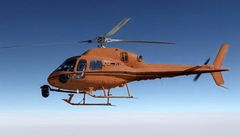
Successful aerial acquisition demands more than just an aircraft; it requires meticulous mission planning, seamless sensor integration, and complete regulatory compliance. Helicopters Over Savannah serves as your primary mission command partner. We meticulously assess your specific data or footage requirements, ensure the selection of the appropriate airframe and qualified flight resources for your unique profile, and manage all necessary flight planning and permit acquisition. This integrated approach provides you with a single point of accountability and a comprehensive, turnkey operational result.
Cinema & Broadcast Videography
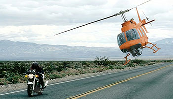
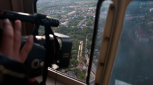
From major feature films to demanding live broadcast events, we provide the stable, high-performance aerial platforms essential for Directors of Photography. We offer comprehensive support for industry-standard stabilization systems, including Shotover, Cineflex, and Tyler Mounts, and coordinate seamlessly with your production crew to ensure flawless shot execution for any project around Savannah or coastal Georgia.
Aerial Photography
Capture high-resolution marketing assets, detailed real estate portfolios, and comprehensive project progress documentation. Our expert aerial teams understand optimal lighting, precise angles, and compelling composition to deliver magazine-quality still images for your most important visual communication needs.
LiDAR & Geospatial Surveying
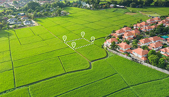
Our services extend beyond the visible spectrum, providing actionable data crucial for informed decision-making across the Savannah region. We facilitate advanced LiDAR acquisitions, high-resolution orthomosaic mapping, and precise 3D terrain modeling, essential for urban planning initiatives, comprehensive utility inspection programs, and meticulous environmental monitoring.
Utility & Asset Inspection
We offer rapid, highly detailed inspections of critical infrastructure such as transmission lines, extensive pipelines, and vital cell towers. The inherent stable hover capability and precise flight control provided are ideal for achieving the high-fidelity asset auditing necessary for infrastructure managers in coastal Georgia.
Technical FAQ
We ensure compatibility with all leading industry mounts, including robust systems like Shotover (F1, K1), Cineflex, and Wescam, enabling diverse project requirements. For creative teams utilizing lighter cinema payloads, we also readily support solutions such as Tyler Minigyro and various Middle mounts.
Successfully navigating urban operations requires meticulous planning, and we manage all necessary airspace authorizations and flight plans for projects across the Savannah metro area. Our operational expertise includes proficiently navigating complex controlled airspace, ensuring every required image or data point is acquired legally and safely.
We provide flexible solutions, whether you prefer a comprehensive, turnkey service with a skilled sensor operator, or if you wish to integrate your own creative team into the aerial operation. Should you utilize your crew, we will provide thorough briefings on essential safety protocols and effective air-to-ground coordination procedures.
Depending on the specific sensor payload utilized, we are equipped to deliver various data formats including raw point clouds (LAS/LAZ), detailed orthomosaic maps (TIFF/ECW), or fully processed 3D meshes. Our process includes collaborating with your Geographic Information System team to guarantee seamless file compatibility and integration.
Gallery
Aerial Photography
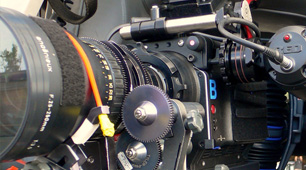
Camera Equipment
Camera Mounts
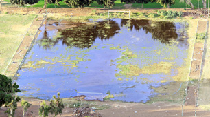
Damage Survey
Real Estate Survey
Aerial Videography
Complete Aerial Photography and Videography for Savannah
Contact Helicopters Over Savannah today at 1-855-445-8965. Receive a swift, no-obligation quote for specialized helicopter aerial photography services tailored for your projects in the greater Savannah area.